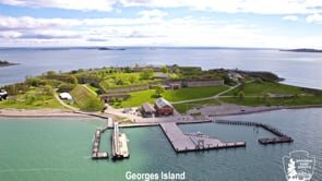
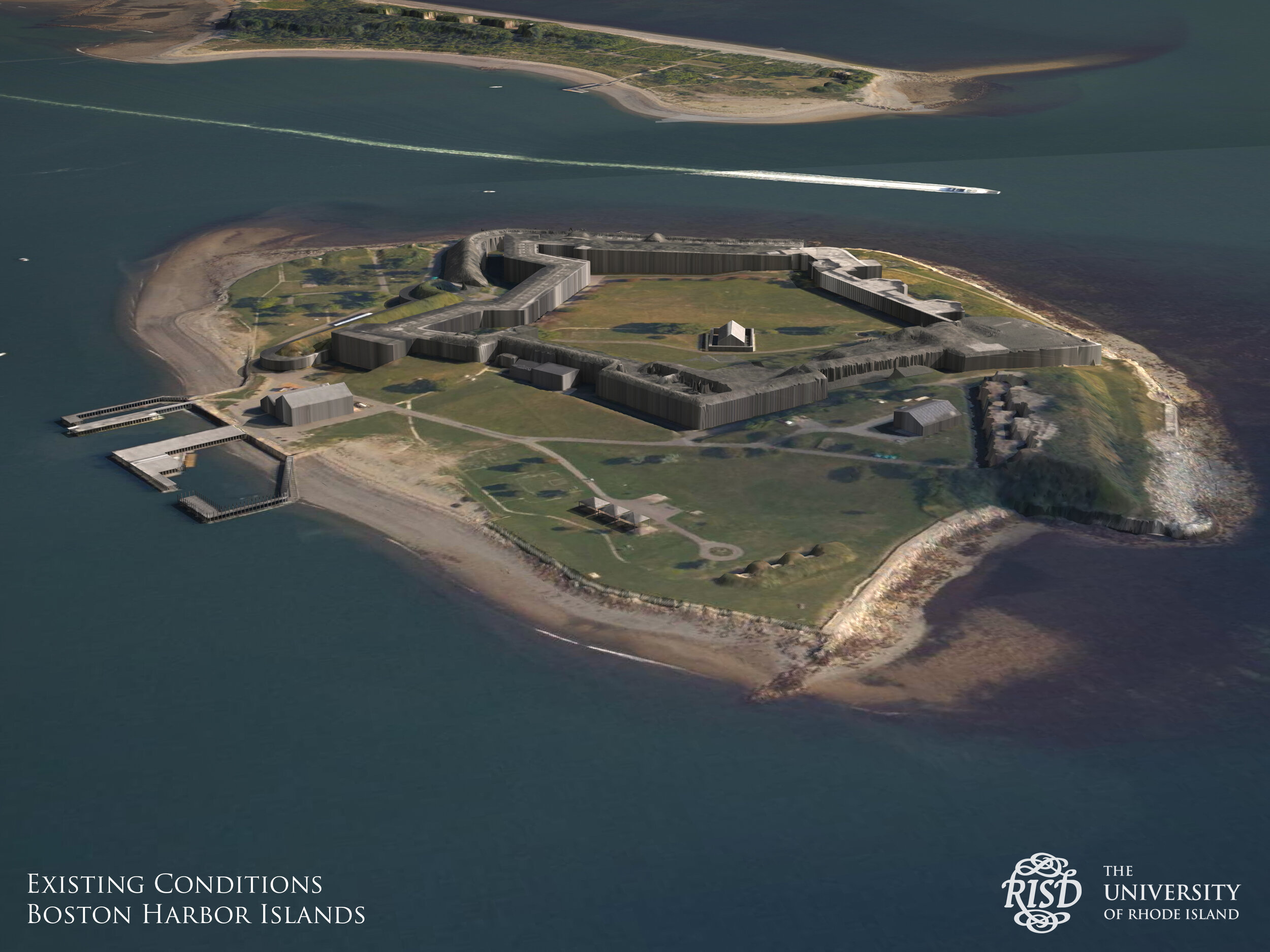
Georges Island with Climate Ready Boston projections
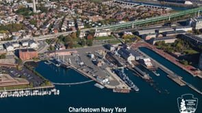
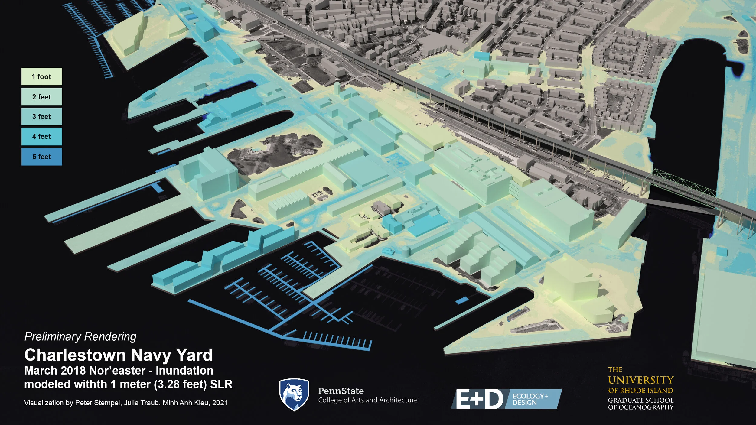
Charlestown Navy Yard with Climate Ready Boston projections
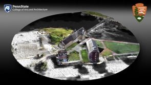
Point Cloud of Slater Mill

Preliminary Visualization of Trenton Bridge.

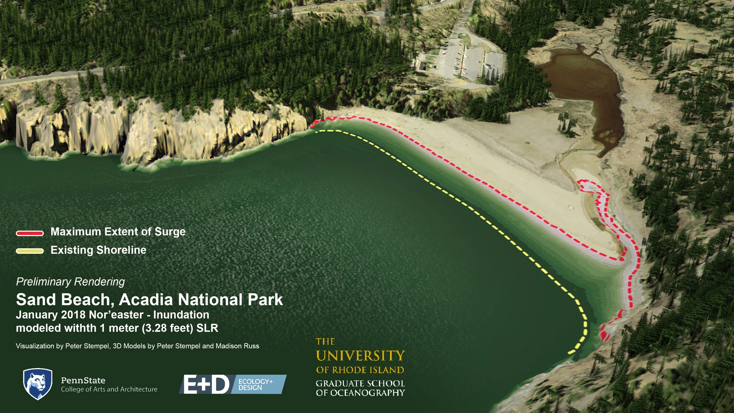
Sand Beach, Acadia National Park

Sand Beach, Acadia National Park
Preliminary Visualization of March 2018 Nor'Easter


Georges Island with Climate Ready Boston projectionsAnimation of Georges island and Fort Warren that transitions from a still photo to a 3D visualization of Climate Ready Boston projections.
Charlestown Navy Yard with Climate Ready Boston projectionsAnimation beginning with a photo of Charlestown Navy Yard that transitions into a 3D visualization of the site with Climate Ready Boston projections.
Point Cloud of Slater MillHigh resolution point cloud contextualized using LiDAR based 3D supporting elements.
Preliminary Visualization of Trenton Bridge.Trenton Bridge, the only road connection to Mount Desert Island, is vulnerable to storm surge and sea level rise.
Sand Beach, Acadia National ParkSand Beach is vulnerable to erosion and sea level rise.
Sand Beach, Acadia National ParkSand Beach is vulnerable to erosion and sea level rise.
Preliminary Visualization of March 2018 Nor'EasterThis visualization features adjusted water levels and dotted boundaries. It is labeled as preliminary because the underlying model by University of Rhode Island Graduate School of Oceanography was still being validated at the time of production and may have been under-predicting surge.
info
/
1
2
3
4
5
6
7
8
9
10
11
12
·
·
·
·
·
·
·
·
·
·
·
·